

By Jenny Pederson
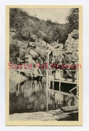
The Bradshaw Mountains of Central Arizona contain many treasures. Among them is an oasis which features outstretched saguaros, an array of desert flowers, palms, a creek, and geothermal spring waters.
 Used by the Yavapai for millenia, the area with the geothermal springs was part of a homestead claim filed by Civil War veteran George Monroe in 1873. Making the claim with three partners, he and his partners subsequently set up a tent camp and established a stagecoach stop. By 1877, the medicinal and health benefits of “taking the waters” were already known.
In 1879, Monroe sold half his interest to Thomas Holland, who built upon the early efforts of Monroe and his partners. He continued to market the Springs’ healing powers, but also constructed a boarding house to add appeal for visitors.
Five years away from a new century, two prominent Prescott names became integral to the story of the Hot Springs: brothers Frank and Nathan Oakes Murphy. A notable figure by 1895, younger brother Frank was already a millionaire although barely 40 years old due to ventures in mining and railroads. Older brother Nathan Oakes Murphy would ultimately be Governor of the Arizona Territory - twice. The brothers saw tremendous opportunity in the Springs for Arizona, with the nationally expanding railroad and because the Southwest was increasingly seen as a desirable winter destination.
Partnering with Holland in 1895, the Murphy brothers brought extensive resources and connections to the table. Within the year, Frank and N. O. established “The Castle Creek Hot Springs and Improvement Company.” In doing so, they spent $75,000 to build a 24-mile wagon road from the closest railroad stop to the resort.
The next decade saw even more changes. Lodging options increased, electricity arrived, tennis was introduced to guests, and 1905 saw the Murphy brothers rebrand the resort to “The Castle Hot Springs Company.”
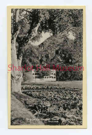
 As the 20th century started to unfold, the reputation of Castle Hot Springs grew. Although continuing to be a popular spot for Arizonans such as Morris Goldwater, it was increasingly visited by nationally known figures and the wealthiest families in America. On the guest list in the early 1900s were the Rockefellers, Vanderbilts, and Roosevelts. By the 1920s, it was one of the most famous and luxurious resorts in the nation. Guests had a range of activities to choose from, including hiking, tennis, golf, swimming, and horseback riding. They attended picnics, dinners, and dances.
In the subsequent decades, as tensions mounted on the world stage, visitors continued to experience everything the resort offered. Horseback riding and trail rides continued to be a draw. Wranglers provided guests with a quintessential “cowboy experience”, and rodeos entertained them. In the midst of World War II, the hotel was leased to the U. S. Government Army Air Forces as a rest center. In 1945, future President Lt. John F. Kennedy spent three months at the Springs recuperating from his injuries.
Following the war, and up to the mid-1970s, guests returned to Castle Hot Springs for entertainment, outdoor adventure, and leisure. Many were members of families that had been coming for generations. However, in 1976, tragedy struck. A fire destroyed the Palm House, a building dating to 1897. As a result, the resort closed and would remain closed to the public for decades.
In 2014, new owners Cindy and Mike Watts bought the property and started a years-long process of revitalization, breathing new life into this venerable Arizona institution.
To learn more about the story of the Castle Hot Springs Resort, from its historic founding to its inspired reinvention, join Kristen Atwell Ford for a lecture and film screening on September 24th. Kristin is a researcher and filmmaker, and the proud recipient of the 2021 Governor’s Arts Award for Artist of the Year. Both will be held at the Sharlot Hall Museum Fred W. Veil Education Center on September 24, 2022. The lecture is scheduled for 2 PM; the film screening starts at 5:30 PM. Seating is limited for both. Call Admissions at 928-445-3122 Ext. 0.
“Days Past” is a collaborative project of the Sharlot Hall Museum and the Prescott Corral of Westerners International (www.prescottcorral.org). This and other Days Past articles are also available at archives.sharlothallmuseum.org/articles/days-past-articles/1 The public is encouraged to submit proposed articles and inquiries to dayspast@sharlothallmuseum.org Please contact SHM Research Center reference desk at 928-277-2003, or via email at archivesrequest@sharlothallmuseum.org for information or assistance with photo requests.