


Home Run Mine
details
Unknown Unknown 1600.0267.0000.jpg M - 267 B&W 1600-0267-0000 m267p Print 5x7 Historic Photographs 1890s Reproduction requires permission. Digital images property of SHM Library & ArchivesDescription
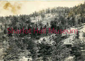
Home Run Mine, Groom Creek, Yavapai County, Arizona Territory, c. 1890s.
The Home Run Mine was a gold mine located in Yavapai county, Arizona at an elevation of 6,801 feet. The mine was in production from the early 1900s until 1940.
Yavapai Magazine, (1918, VOL VI, NO 7, P. 2) said the Home Run “was developed by the Douglas Lacy Co., brokers, who were more interested in selling stock than in making a mine. The first Nissen mill ever put in service was installed by Mr. P. E. Nissen himself. It had a daily capacity of from 25 to 30 tons. A shaft was sunk 400 feet, with drifts at each level. Several thousand tons of ore were milled, but the ore was complex and the savings were not satisfactory. The values are in gold and silver, with iron and lead sulphides. The property has been idle for many years. It belongs to A. A. Johns and T. J. Laird."
Descriptions from both the Western Mining History and The Diggings websites describe the history and geology of the mine: "The Home Run Mine was located near Prescott, Arizona in what was historically known as the Groom Creek Mining District. This district is now a part of the Prescott National Forest. The production output of the Home Run Mine was relatively small in scale. The mining operations primarily took place underground, with the presence of one known shaft. The deepest point of the mine extends approximately 140 meters (460 feet) below the surface, while the total length of the mining workings stretches out to 762 meters (2,500 feet). At the Home Run Mine, the ore that was extracted consisted of galena and gold. The waste material associated with the mining process primarily consisted of quartz and pyrite. The ore body itself was described as having a tabular shape, measuring about 0.76 meters (2.49 feet) in thickness. The surrounding rock in this area is primarily composed of rhyolite. In terms of the geological and geographic characteristics of the area, the Home Run Mine is situated within the Mexican Highland region of the Intermontane Plateaus. This geomorphological setting helps define the landscape and terrain of the surrounding area."
Purchase
To purchase this image please click on the NOTIFY US button and we will contact you with details
The process for online purchase of usage rights to this digital image is under development. To order this image, CLICK HERE to send an email request for details. Refer to the ‘Usage Terms & Conditions’ page for specific information. A signed “Permission for Use” contract must be completed and returned. Written permission from Sharlot Hall Museum is required to publish, display, or reproduce in any form whatsoever, including all types of electronic media including, but not limited to online sources, websites, Facebook Twitter, or eBooks. Digital files of images, text, sound or audio/visual recordings, or moving images remain the property of Sharlot Hall Museum, and may not be copied, modified, redistributed, resold nor deposited with another institution. Sharlot Hall Museum reserves the right to refuse reproduction of any of its materials, and to impose such conditions as it may deem appropriate. For certain scenarios, the price for personal usage of the digital content is minimal; CLICK HERE to download the specific form for personal usage. For additional information, contact the Museum Library & Archives at 928-445-3122 ext. 14 or email: orderdesk@sharlot.org.