By Terry Munderloh
Long before the Spanish occupation of what would one day become Arizona and the arrival of Euro-American explorers and settlers to the western frontier, a unique aboriginal population lived in present-day Yavapai County. Ruins of many of the structures built by these Amerinds dot the hilltops throughout our surrounding countryside.
Perhaps the first English accounts of the existence of these ruins were recorded by Amiel Whipple in the military reports of his 1854 scouting expedition for a transcontinental railroad route. Whipple particularly described in detail several of the ruins he found along Walnut Creek. In fact, there was such a profusion of ruins in that area, that Whipple's original name for Walnut Creek was Pueblo Creek.
In 1906, Dr. Jesse Fewkes, an ethnologist with the Smithsonian Institute, spent several months in Arizona doing surface studies of the antiquities in the upper Verde River and Walnut Creek areas reported by Whipple. By that time, many of the more accessible ruins along Walnut Creek had been looted of artifacts or dismantled, the rocks being recycled by homesteaders for use in their own structures.
Most archeologists and anthropologists of the mid-twentieth century showed little interest in the unpretentious ruins and the utilitarian simplicity of the pottery left by these particular, prehistoric dwellers which were eclipsed by the towering cliff houses, grand pueblos and fine ceramic and ornamental handicrafts of the Anasazi, Hohokam and Mogollon Indians.
When a man named Kenneth LeRoy Austin came to Prescott in 1971, little was known about the hilltop sites in this area and putting the jigsaw pieces of the placement of these sites together into a cultural picture became his passion and avocation.
Ken was born in New Hampshire in 1896 and received his education both in the United States and Europe. He was in France when World War II broke out and drove an ambulance at the front for the French Army. When the United States entered into the war, Ken enlisted in the U.S. Army and was commissioned a second lieutenant in the field artillery. After the war, he married Marquerite Gerard, a young French lady, and the couple returned to New York where Ken worked on the Wall Street staff of the New York Times for almost twenty years and later in the field of public relations before his semi-retirement to Prescott.
Working as a volunteer for the Prescott National Forest and also through the Museum of Northern Arizona, Ken took on the ambitious task of locating and mapping hilltop sites in west-central Arizona. Ken did not have the luxuries of Global Positioning Systems or aerial photography technology at his disposal, only an old battered 4X4 and anybody he could coax into accompanying him on his almost daily excursions to explore hilltops, mountains and mesas.
The science of discovery involves the process of elimination and it is possible to calculate how many hours of driving and hiking Ken spent to reach the summit of a potential site. Sometimes his reward for a day's outing was only to discover some peccary had chewed off prickly pear or an abandoned pack rat's nest. But his overall success rate was phenomenal. From 1972 through 1978, Ken visited and recorded the locations of 1,089 archeological sites.
It is believed that the "Mountain" Patayans who built these hilltop structures were Yuman-speaking descendents of the archaic Hokan who traveled down the Pacific Coast some 2,000 years ago and then moved east to the Colorado River regions. Overcrowding of the Colorado Valley and internecine quarrels between its inhabitants spurred further migrations in search of food and greater living room.
The Patayans of our region probably traveled up Bill Williams River and then dispersed into smaller groups. Evidence of their population indicates that some groups continued up the Santa Maria River then traveled east along Granite Mountain down to Lynx Creek and the base of Mt. Union while some traveled along Kirkland Creek to the Hassayampa River Region. Other migrating bands followed Burro Creek and pursued three separate routes: one northwest to Mt. Hope and into Big Chino Wash, another along Walnut Creek to Hell Canyon and the Verde River headwaters and the third across Hyde Mountain into the area of Mint Wash and Granite Creek.
As Ken diligently pursued his fieldwork, a pattern for the site locations began to emerge. He identified five different kinds of type-sites. Forts: large stonewalled structures with one or more entries. Lookouts: small, stonewalled structures. Natural lookouts: craggy buttes or mesa rims not requiring man-made additions for human concealment. Compounds: "villages" that occupied entire mesa summits with partial outer walls. And the fifth type-site, houses: few in number, most having companion residential sites nearby.
Perhaps it took the eye of a veteran artilleryman like Ken to recognize the strategic placement of lookouts relative to dwelling sites and defendable fort locations that formed a complex communications network. Most of the lookouts were sited above main trail routes or riparian area farmed by the Patayans. By line-of-site, smoke signals could be sent from lookouts to inhabited sites to warn of invasion. These line-of-site chains were very extensive and overlapping and signals could be relayed from site to site for many miles all the way from Mt. Hope through Walnut Creek on to Williamson and Chino Valley and across to Perry Mesa.
Ken's scholarly research is a viable resource of information still consulted by today's archaeologists and para-archaeologists. David Wilcox, Senior Curator of Anthropology at the Museum of Northern Arizona, is continuing Ken's research into line-of-site chains and the tribal political boundaries Austin hypothesized were the basis for the locations of these defensive communication networks which were apparently in use until about 1250. David is assisted by a cadre of volunteers and sight stewards as avid as Ken was who contribute their time, expertise and technological resources to his ongoing study. Wilcox's studies indicate that the line-of-site communication networks extended even farther than Austin proposed. He will be presenting his latest findings on Tuesday March 12 at the Sharlot Hall Museum at 7:00pm.
Ken Austin died on February 8, 1980 and memorial services for him were held at the Bashford House at Sharlot Hall Museum. According to the terms of Ken's will, his large collection of site information was bequeathed to the museum's archives (however, most archeological records are restricted to use by archeologists only). His paper, "The Mountain Patayan of West-Central Arizona," edited by David Wilcox, was published posthumously in 2000 by the Sharlot Hall Museum Press in "Archaeology in West-Central Arizona, Proceedings of the 1996 Arizona Archaeological Council Prescott Conference".
(Terry Munderloh is a volunteer at the Sharlot Hall Museum's Archives. March is archeology month and the Museum has many events scheduled. Call them at 445-3122 for complete information or visit sharlothallmuseum.org.)
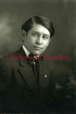
Sharlot Hall Museum Photograph Call Number: (po2158p). Reuse only by permission.
During the 1970s Ken Austin began to survey Native American hilltop sites in Yavapai County. All he had was an old battered 4X4 and his careful note taking. He usually tried to find someone he could coax into accompanying him on his almost daily excursions to explore hilltops, mountains and mesas.